Pala Neighborhood Evacuation Maps
Welcome to the Pala Reservation Emergency Preparedness (PREP) Neighborhood Evacuation Maps page.

Welcome to the Pala Reservation Emergency Preparedness (PREP) Neighborhood Evacuation Maps page.

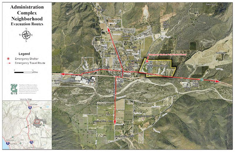
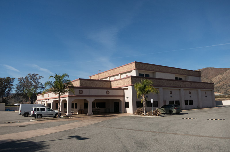
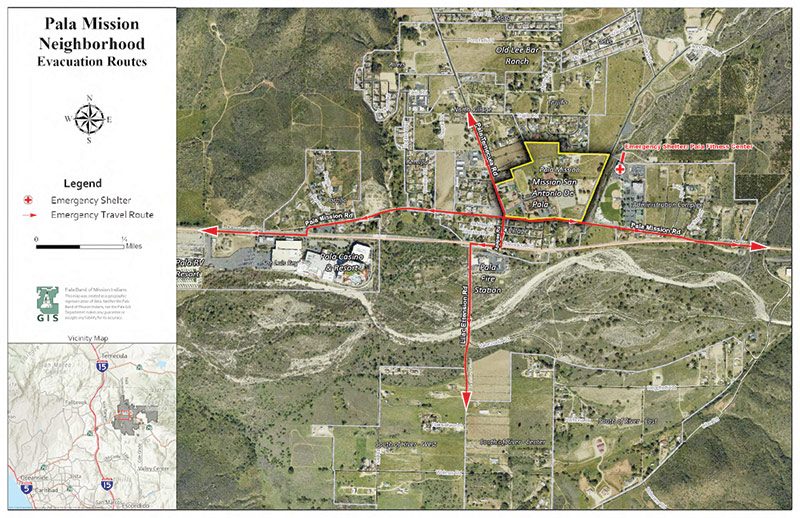
The Pala Emergency Shelter is located in the Pala Fitness Center (map) at the north end of the Pala Administration Complex and is accessible only via Pala Mission Road.

Pala Neighborhoods
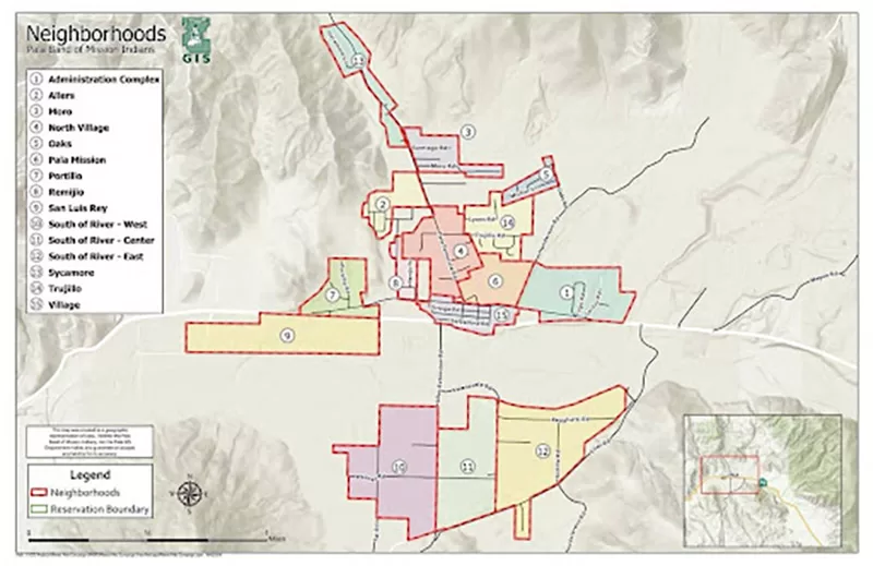
The Pala Reservation encompasses 20.140 square miles and comprises 15 neighborhoods.
Pala Roads
Evacuation Travel Routes are accessed through 5 main roads.

Pala neighborhood maps were created for each of the 15 Pala neighborhoods. The maps include the boundaries of each neighborhood and evacuation routes. Shared roads and clusters of houses and buildings defined the neighborhoods.
This neighborhood, which includes the Pala Administration Complex, has a handful of houses situated along paved and unpaved roads that intersect with the eastern portion of Pala Mission Road.
Download the PDF version of this map.

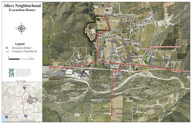
The Allers neighborhood includes several newer houses set along a short circuit road and a spur that ends in a cul-de-sac. Access is via Nejo Road, which intersects Pala Temecula Road and crosses Pala Creek. The neighborhood sits against a brush-covered hill.
Download the PDF version of this map.
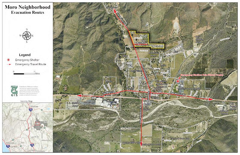
This neighborhood is characterized by houses set close together along Moro and Santiago Roads, which intersect Pala Temecula Road. It is surrounded by open fields.
Download the PDF version of this map.
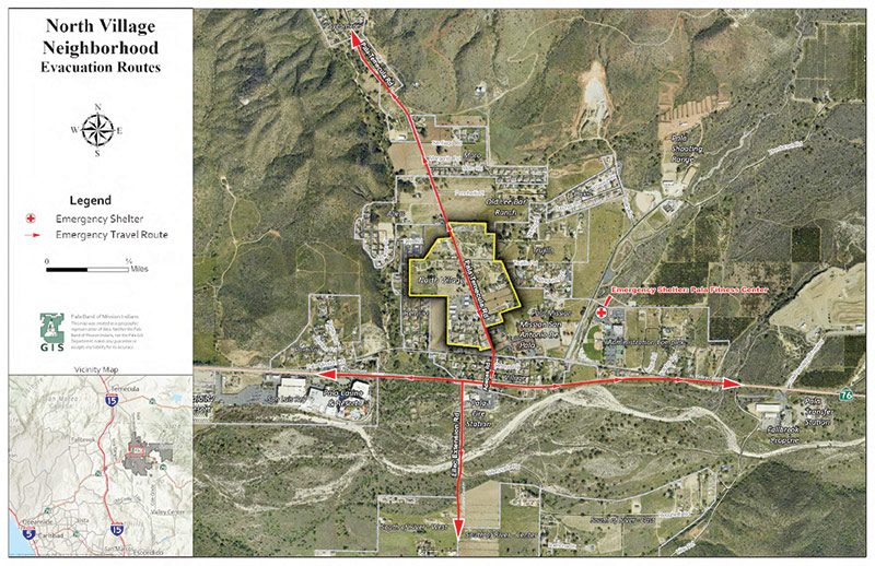
North Village is bisected by Pala Temecula Road. The houses in this neighborhood are farther apart, with the largest cluster around Robles Road.
Download the PDF version of this map.
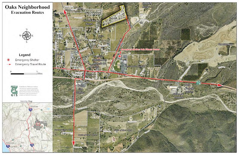
Oaks is the newest neighborhood in Pala. It is reached via Henderson Road, off Pala Mission Road, and has houses arranged along three lanes ending in a cul-de-sac. The neighborhood is surrounded by fields.
Download the PDF version of this map.
This neighborhood has only three houses, but it also includes Pala Child Care, Pala Learning Center, Pala Youth Center, and the Pala Mission and San Juan Diego Center. It is bordered by Pala Temecula Road, Pala Mission Road, and Henderson Road.
Download the PDF version of this map.
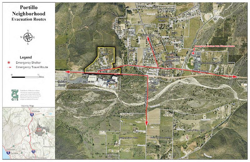
The Portillo neighborhood sits along the western portion of Pala Mission Road, across from the Pala Casino. Several of the houses in this neighborhood are mobile homes and trailers. It is surrounded on three sides by brushy hills and open space.
Download the PDF version of this map.
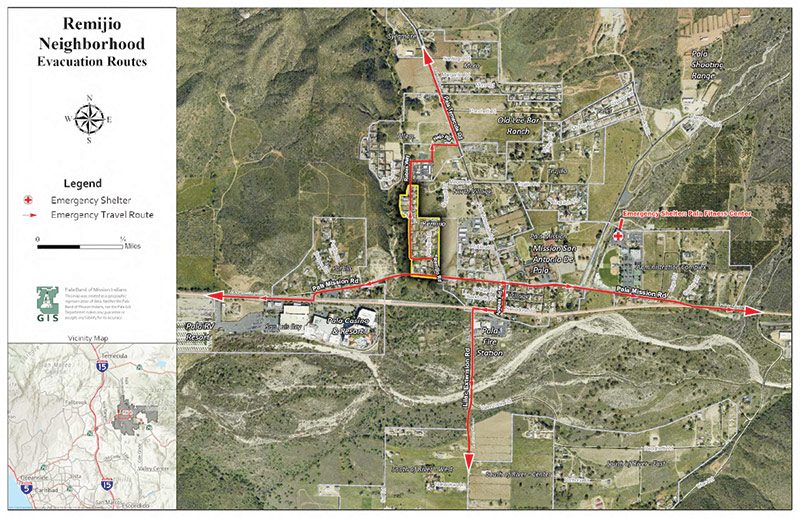
Remijio is accessed via Pala Mission Road and consists of houses arrayed along two streets. Pala Creek borders the west side of the neighborhood, and open fields lie to the north and east.
Download the PDF version of this map.
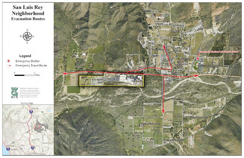
San Luis Rey includes the Pala Casino, hotel, and RV Park, along with two homes. It is directly south of Highway 76 and borders the San Luis Rey River.
Download the PDF version of this map.
Like the other neighborhoods south of the river, this neighborhood has a few widely scattered houses surrounded by open space. It is north of Lilac Road and between Lilac Extension Road and Valenzuela Road.
Download the PDF version of this map.
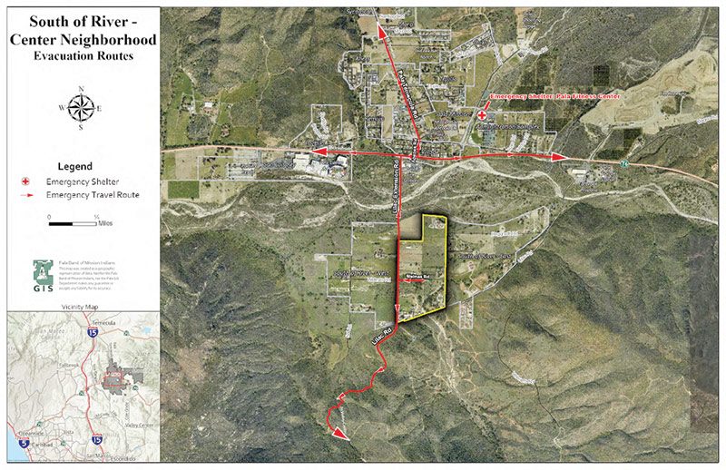
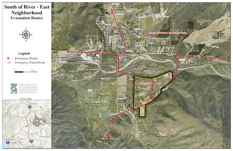
This neighborhood includes a cluster of houses on Pala Lilac Road, as well as more separated houses between Lilac Road to the south and the San Luis Rey River to the north. The neighborhood is bordered by brushy hills and is mostly undeveloped open space.
Download the PDF version of this map.
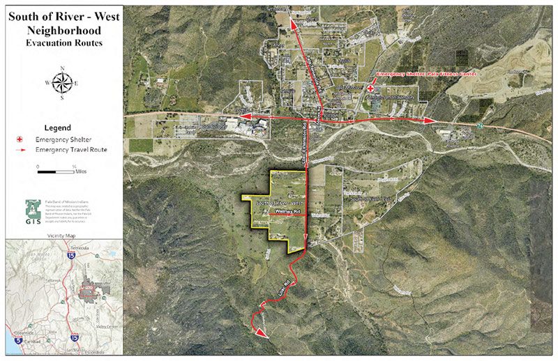
Bordered by Lilac Extension Road to the east and Lilac Road to the south, South of the River – West has a handful of widely separated houses and a small cluster of mobile homes located within mostly open space south of the San Luis Rey River.
Download the PDF version of this map.
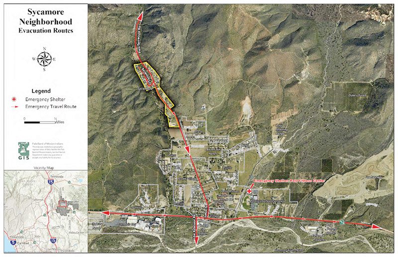
The Sycamore neighborhood is the northernmost neighborhood and is bisected by Pala Temecula Road. Most of the houses are along Sycamore Lane, which crosses Pala Creek to the east and is bordered by a steep, brush-covered hill to the west. Sycamore Lane has only one access point.
Download the PDF version of this map.
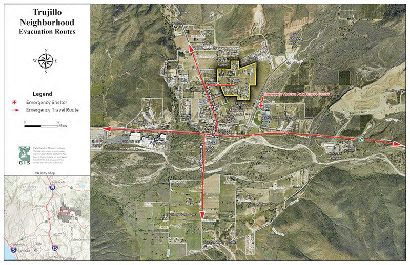
Trujillo has several houses accessible via Trujillo Road, off Pala Temecula Road. There are several houses built close together in the southern part of the neighborhood, along a few lanes ending in cul-de-sacs. The rest of the homes are more widely spread to the north of Trujillo Road.
Download the PDF version of this map.
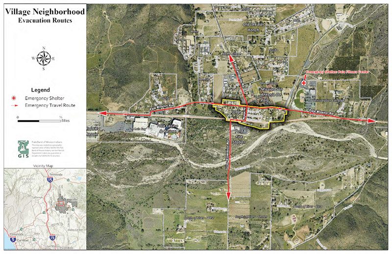
The Village neighborhood consists mainly of homes built on the original village allotments between Highway 76 to the south and Pala Mission Road to the north. This is the closest neighborhood to the Pala Fire Department.
Download the PDF version of this map.

Visit Pala Reservation Emergency Preparedness (PREP) to learn more about the project.